Google has officially introduced an Android emergency alerts map view to help users instantly visualize the exact scope of a crisis relative to their current location. Rolled out via Google Play services v26.12, this critical update transforms traditional text-based Wireless Emergency Alerts into interactive visual tools. The enhancement aims to eliminate the confusion of trying to decipher vague geographical descriptions during high-stress situations.
Historically, Wireless Emergency Alerts have relied entirely on text descriptions to convey danger zones. This legacy format often hindered users' understanding of an emergency's true scope, leaving them unsure if they were directly in the path of a threat. By integrating a visual map directly into the notification, Google aims to drastically improve user decision-making during critical moments.
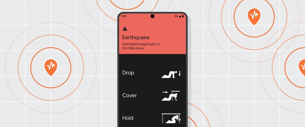
The updated system covers a wide range of critical situations, including missing child alerts, natural disasters, imminent threats, and early earthquake warnings. Because these alerts are broadcast by government agencies over dedicated cellular channels, the notifications are guaranteed to reach users even when traditional mobile networks are heavily congested. Crucially, the map view allows users to access this vital location-based information without needing to launch a separate application.
What to Expect from the Update
- Visual Context: The alert will now display a map highlighting the affected area alongside your real-time location.
- Gradual Rollout: The feature is tied to Google Play services v26.12 and is rolling out gradually, meaning it may take some time to reach all Android devices.
- Offline Reliability: The system continues to utilize dedicated cellular broadcast channels to bypass standard network congestion.
The Shift Toward Visual Crisis Management
Google’s decision to integrate a map view into Android's Wireless Emergency Alerts represents a vital evolution in public safety technology. By tying this update to Google Play services v26.12 rather than a full system OS update, Google ensures that a massive array of Android devices can receive this life-saving feature without waiting for manufacturer-specific firmware rollouts.
The transition from text to visual data addresses a fundamental flaw in legacy emergency systems: cognitive overload. During natural disasters or imminent threats, reading and interpreting geographical boundaries is significantly slower than glancing at a map. This update not only modernizes the alert system but sets a new standard for how mobile operating systems should handle critical, location-based crisis communication.